Archeologists have at their disposal a wide array of technology that can help us identify and analyze sites. Geophysical survey is one way to investigate archeological sites before, or instead of, testing and excavation. Various remote sensing techniques can give us a picture of what may be underground before a single shovel hits the dirt. In addition to site discovery, remote sensing can help us decide where to dig, or in some cases if excavation is even necessary. The data collected during geophysical surveys need to be processed and interpreted, but the whole process is often faster and cheaper than test excavations and can cover a far greater area than pedestrian survey and systematic testing. After interpreting the results of the survey, it may still be necessary to test some locations, but those tests can be placed in locations with the greatest potential to yield information. In many cases, non-invasive techniques like this can help us preserve sites by avoiding certain locations.
These tools do come with some limitations, but are nonetheless invaluable aids to archeological research. The following are a few examples of the various technologies used by archeologists.
Geographic Information Systems (GIS)
How it works: GIS is a system for creating, managing, analyzing, and displaying data. It allows for the creation and manipulation of maps that contain multiple layers of data and tools for analyzing those data.
How it is used in archeology: In addition to using GIS to map and track archeological sites and surveys, it can help us identify patterns and relationships in large datasets.
Ground Penetrating Radar (GPR)
How it works: A transmitter sends an electromagnetic signal into the ground that returns to the receiver when it encounters changes in subsurface materials. These distortions in the reflected signal can be caused by soil changes, chemical variations, and objects.
How it is used in archeology: GPR can help archeologists identify buried buildings and foundations, tunnels, burials, and even the location of individual artifacts. Most importantly GPR shows at what depth features and objects are located.
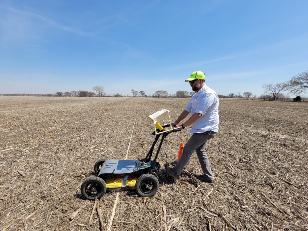
Dave Williams, State Archeologist, demonstrates the use of a GPR device in search for the Omadi Cemetery in Dakota County.
LiDAR (Light Detection and Ranging)
How it works: Lasers are rapidly pulsed from an aerial platform (e.g. a helicopter, airplane, or drone) and the LiDAR system records how long it takes for the beams of light to bounce off the earth and return. The distance the beam traveled is calculated from the time it took to return to the transmitter and then a digital elevation model (DEM) is generated that shows subtle terrain changes and features that may not be visible otherwise.
How it is used in archeology: High resolution elevation maps can be created from LiDAR data. One of the benefits LiDAR affords archeologists is that vegetation can be removed from the DEM, which could uncover features like trail ruts, lodge depressions, or structural foundations that cannot be seen through grass and tree cover during pedestrian survey.
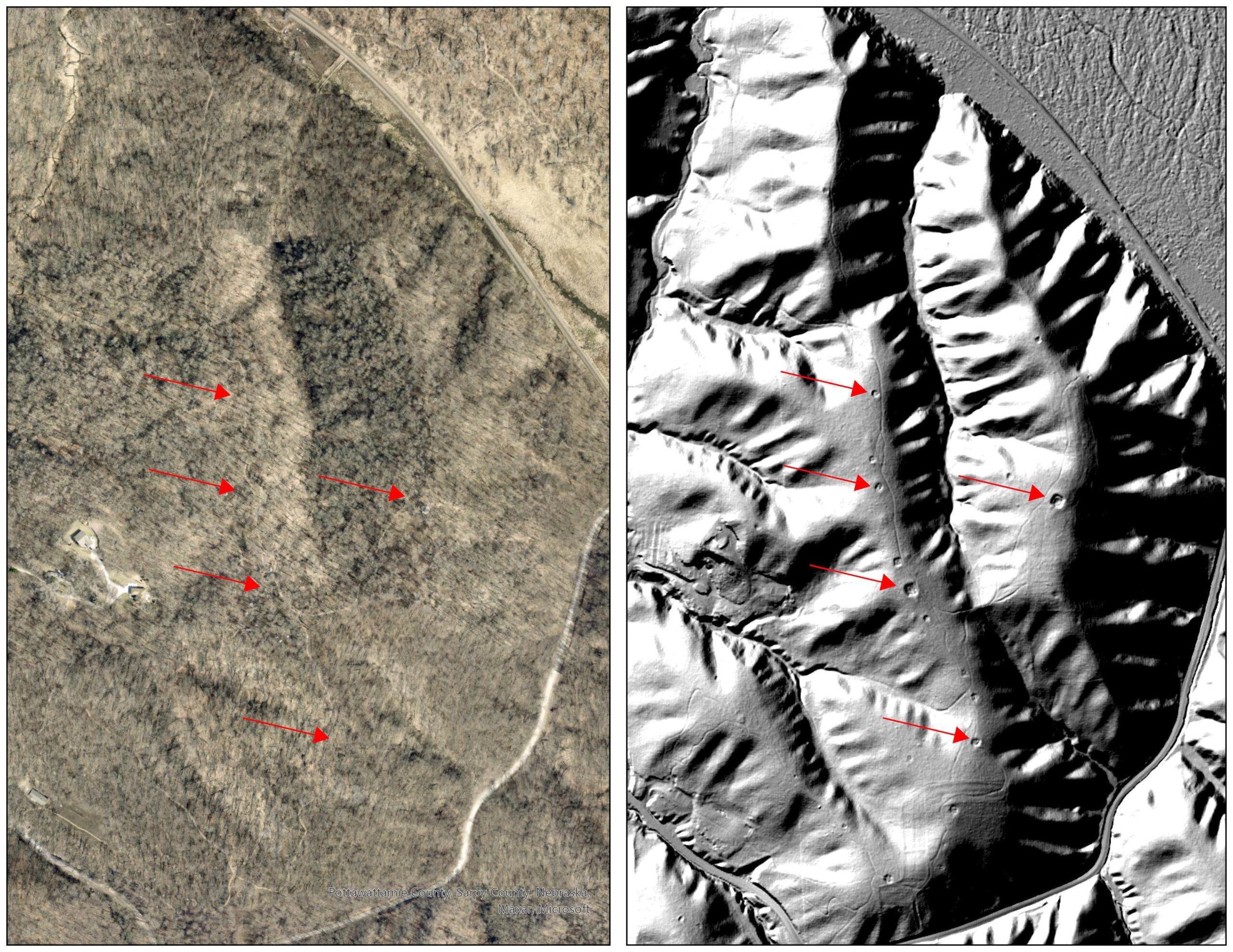
An aerial LiDAR photo of earth lodge depressions in Sarpy County.
Electrical Resistivity
How it works: An electrical current is passed through the soil and the resistance of features is measured as the current passes through.
How it is used in archeology: Features with high resistivity can indicate buried walls, roads, and rubble, while features with low resistivity could be pits, ditches, or graves.
Magnetometry
How it works: A gradiometer records changes in the magnetic field caused by buried features and artifacts that are different than the surrounding soil. Multiple sensors can be linked together on a cart to simultaneously take readings, allowing coverage of much larger areas in less time.
How it is used in archeology: Aside from iron objects and magnetic rocks, a magnetometer is particularly useful in identifying burned structures and hearths, as well as pit features and burials.
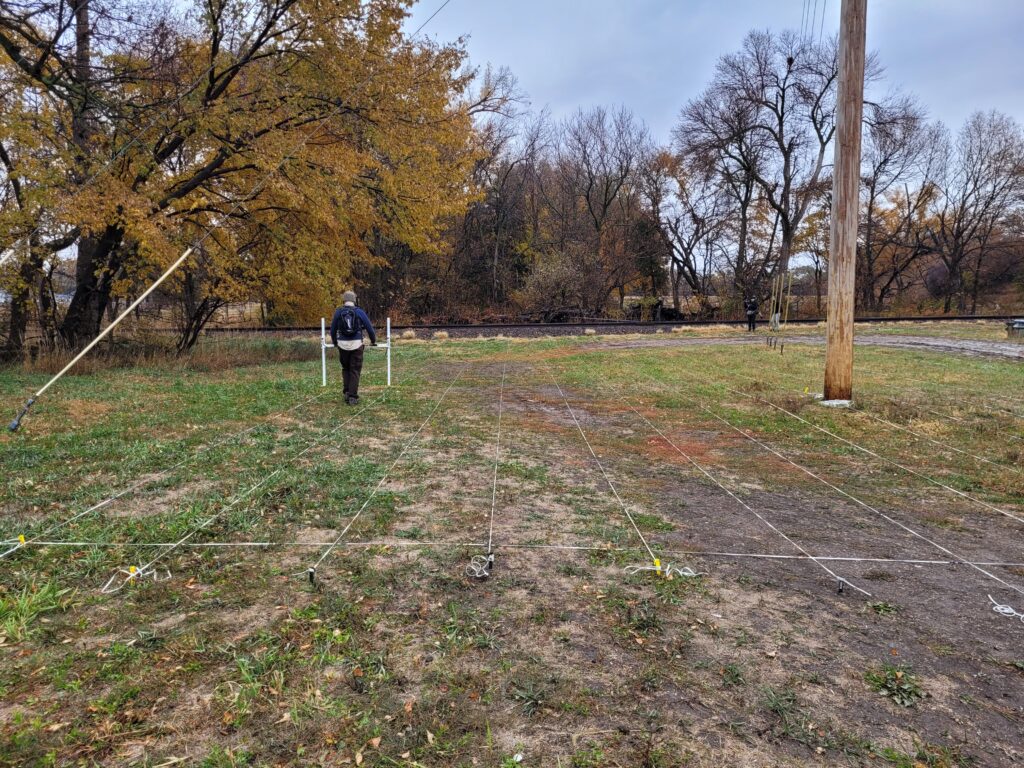
A magnetometer was used in October 2022 in search for the Genoa Industrial Indian School Cemetery.
EMI Conductivity
How it works: Electromagnetic induction (EMI) sensors use low frequency magnetic fields to induce currents and measure the ability of the soil to conduct electricity.
How it is used in archeology: Changes in conductivity may be natural formations or the result of human activity that have caused a change in the subsurface soil composition. These disturbances can indicate habitations, structural materials, roads, graves, metal objects, and more.
Metal Detectors
How it works: An electromagnetic field is transmitted into the ground and metal objects that it encounters are energized. The metal detector then receives the signal from the electromagnetic field generated by those objects.
How it is used in archeology: Metal detecting can help identify and evaluate sites (that contain metal objects) with far less effort than traditional survey and testing methods, especially where pedestrian survey and shovel testing would be impractical.