By Nolan Johnson, NSHS Archeologist
LiDAR is one of my favorite tools as an archeologist. What is LiDAR you may ask? LiDAR stands for “Light Detection and Ranging” and is essentially lasers from space, an airplane, or an earthbound scanner. In a nutshell, lasers are bounced off of the ground surface back to a fixed receiver, creating detailed elevation maps. So many individual data points are collected that LiDAR can see through and around vegetation, which is what makes it so valuable to archeologists.
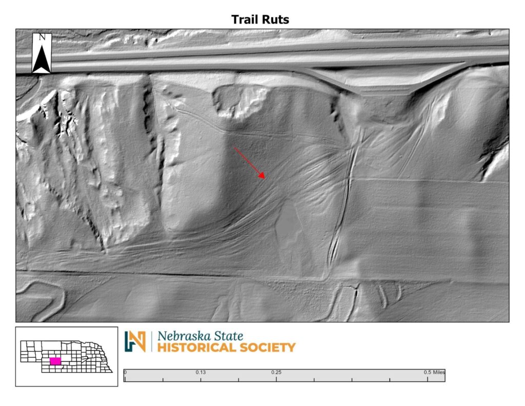
In this LiDAR image, you can see the wagon ruts from the Overland Trail near the Sutherland rest area along I-80. Check out this NSHS historical marker for more information.
The State Archeology Office has access to LiDAR data across the entire state and we use them often to identify things not readily visible because of dense surface vegetation or lack of a big-picture perspective. LiDAR data can facilitate more targeted approaches to fieldwork, lowering costs and increasing efficiency in completing projects.
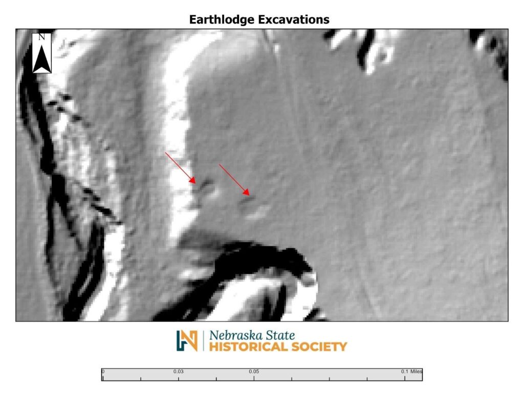
Shown in this LiDAR image are two precontact earth lodges that were excavated in 1939 and never filled in. The east-facing entranceway in the farther southeast lodge can still be seen.
Published February 2025