History Nebraska RG2102-1-5
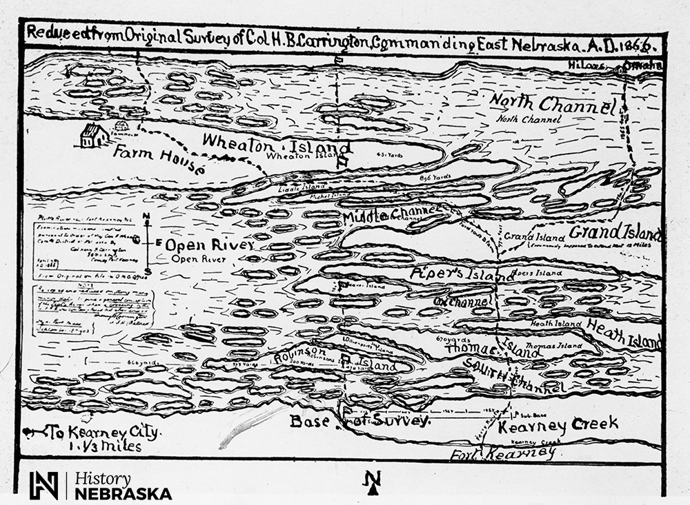
How difficult was it to cross the Platte River without a bridge? This 1866 map gives you some idea. The river was notorious for its braided channel and patches of quicksand. The map shows the best places to ford.
But some things are confusing to modern eyes. What is Kearney City (lower left) doing south of the river and west of the fort? And what’s this about Grand Island being north of the fort?
Kearney City, informally known as Dobytown for its abode buildings, was described by an 1860 visitor as a “gambling hell” populated by “as bad a crowd of men and women as ever got together on the plains.” The present city of Kearney was founded in 1872 north of the river.
Grand Island, meanwhile, was not a city, but a long island nestled between Wood River and the Platte. It was named “La Grande Isle” by 18th century French traders. The town originally known as Grand Island Station was founded the same year this map was drawn, but well to the east.
— David L. Bristow, Editor


