Here’s a panoramic view of Scottsbluff from about 1910. It’s too wide for this blog, so we’ve broken it into pieces below.
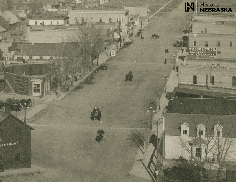
Scottsbluff is one of the younger cities in Nebraska, platted in 1899. (In neighboring Gering, residents will remind you that their city was founded earlier, in 1887.) This photo was taken from a water tower that no longer exists. The street just left of center is Broadway, looking north. The city was barely a decade old, but downtown already boasted a few blocks of brick buildings and streetlights.
Overland Street frames the view left (west) and right (east). Vehicles on the unpaved streets are still mostly of the horse-drawn variety, though a few early automobiles are visible. And in the far right, smoke rises from the Great Western Sugar Company’s new plant.
Here’s a closer view in three sections, left to right:
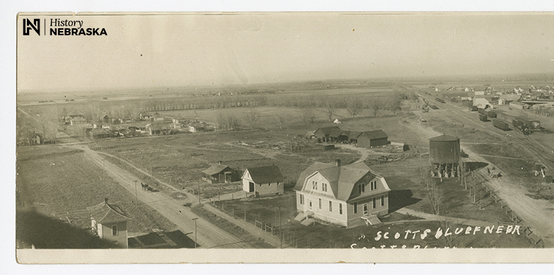
The road on the left leads west out of town. The bluff itself (today’s Scotts Bluff National Monument) is to the left of this view. (Photo: History Nebraska RG2528-6-2)
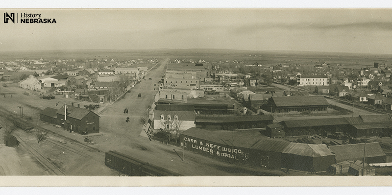
Broadway and the heart of town.
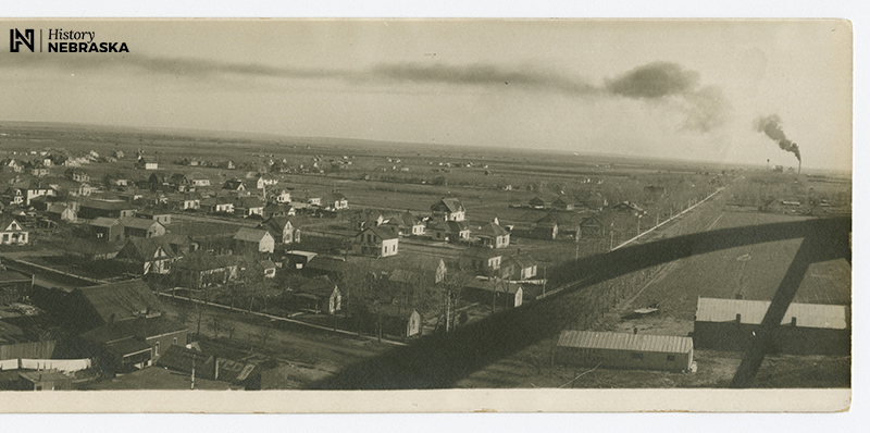
The road on the right heads east toward the new Great Western sugar plant, where locally grown sugar beets were processed into table sugar.
Zooming in even closer, here’s a detail of the business district on Broadway:
Scottsbluff changed dramatically over the next generation. Below is an aerial photo taken March 7, 1947. The view is to the north by east:
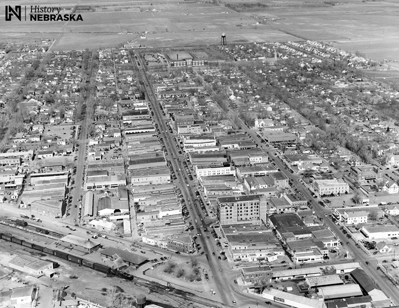
Unlike the circa-1910 view, many of the houses and buildings shown here still exist today. Here’s a closer look at Broadway:
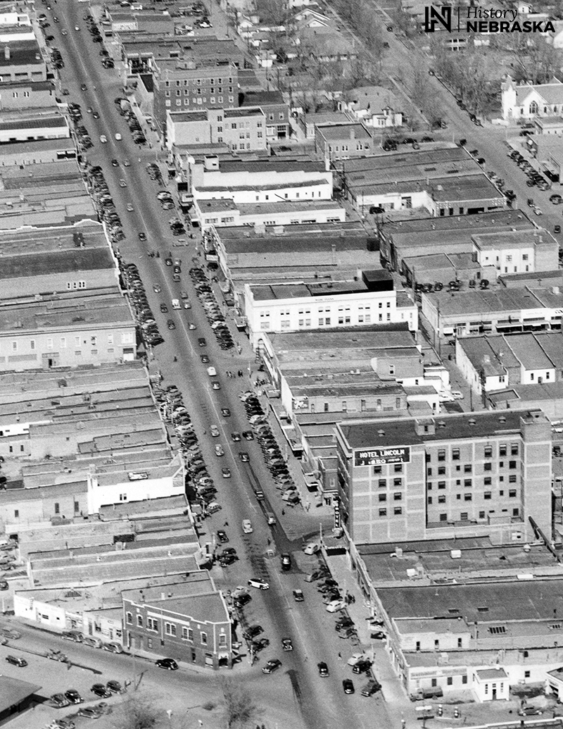
Several of these buildings are listed on the National Register of Historic Places. Find them on this interactive Nebraska map. Search “Scottsbluff,” then zoom out a bit to see all the listed properties.
— David L. Bristow, Editor

