Most of us take road maps for granted. It’s easy for today’s travelers to get a clear map to guide
them on their way. Not so with early voyagers across Nebraska’s “sea of grass;” they had to
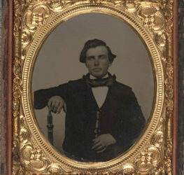
make their own maps. Among the most important of these chart-making explorers was Captain
John C. Fremont.
Fremont led five expeditions to explore the West between 1842-1853. The 1842 trip was in
some ways most significant, because it outlined the Platte Valley-South Pass route that would
be used by most California- and Oregon-bound emigrants. A rare set of seven maps that trace
this journey has been acquired by the Nebraska State Historical Society. Printed in 1846, the
maps are based on Fremont’s field journal, as well as sketches and notes by topographer Charles
Preuss.
Section II of the seven-map set depicts “the Great Platte River Road” from present-day Grand
Island to beyond what’s now North Platte. Even more fascinating than the thin line of river and
surrounding topography are the comments printed on the map. “Remarks” include “Timber is
extremely scarce, except on the islands. Some driftwood and buffalo excrement makes the fuel,
as that of camels does in the deserts of Arabia.”
Something of the excitement of encountering a new environment for the first time is conveyed
in this note from Fremont’s journal, printed on the map near Brady’s Island:
“First view of buffalo. The air was keen the next morning at sunrise, the thermometer standing
at 44 degrees and it was sufficiently cold to make overcoats very comfortable. A few miles
brought us into the midst of the buffalo swarming in immense numbers over the plains, where
they had left scarcely a blade of grass standing. Mr. Preuss, who was sketching at a little
distance in the rear, had at first noted them as large groves of timber. In the sight of such a
mass of life, the traveller feels a strange emotion of grandeur. We had heard from a distance a
dull and confused murmuring, and when we came in view of their dark masses, there was not
one among us who did not feel his heart beat quicker. It was the early part of the day when the
herds are feeding, and every where they were in motion. Here and there a huge old bull was
rolling in the grass and clouds of dust rose in the air from various parts of the bands, each the
scene of some obstinate fight. Indians and buffalo make the poetry and life of the prairie and
our camp was full of their exhilaration.”
Californians For Nebraska provided funds to purchase the maps. They will eventually be
exhibited at the new Historical Society museum at Chimney Rock.